Local Maps
There are several maps available covering our area. The earliest is called Myers and is dated around 1830. What is very noticeable is how few buildings are shown and how much is farm and park land.
Please note that the quality of the maps in this topic is restricted by the publishing software. You will get much better images by going to the sources indicated.
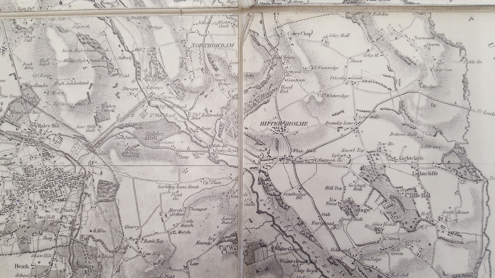
It’s also interesting to look at some of the spellings of the houses or even the odd error – Smith House is called South House. This is available to view in the Local Studies section of the Central Library in Halifax
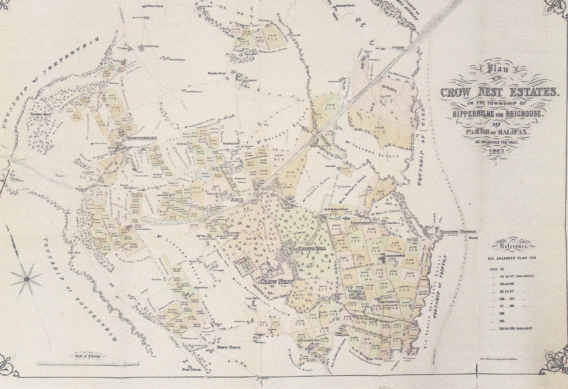
In 1867 a large part of the area was put up for auction. Here is one of the maps that was included in the sale catalogue. Versions of this are available for a small charge from the Central Library.
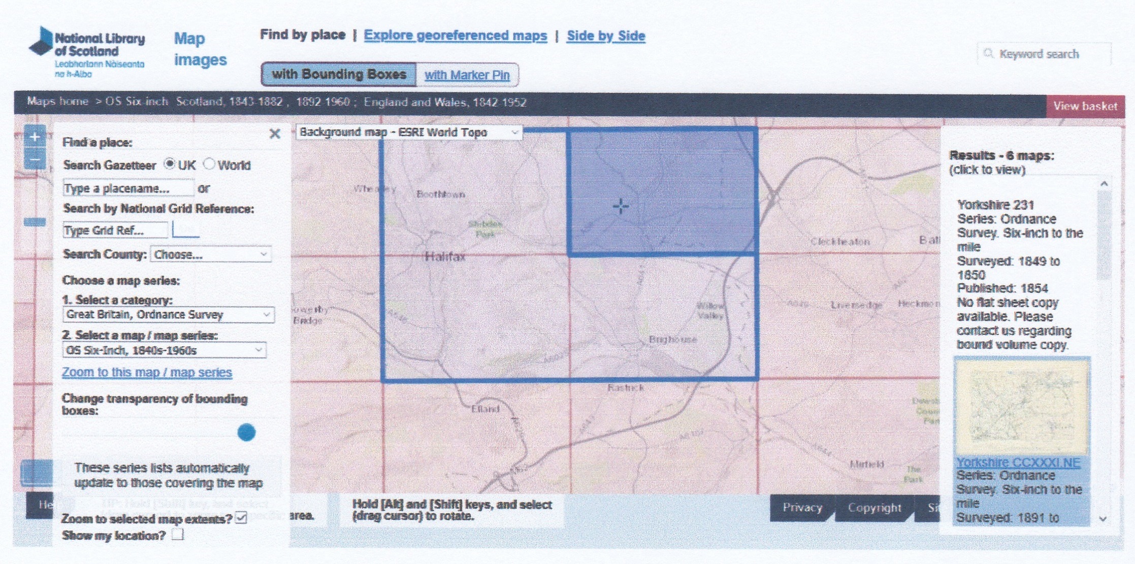
There is now an on-line version of later maps from the Scottish Library.
https://maps.nls.uk/geo/find/#zoom=12&lat=53.7233&lon=-1.8060&layers=102&b=1&z=1&point=53.7345,-1.7859 If the live link doesn’t work, Copy & Paste the address into your web browser.
This will get you to a screen like this. If you move the cursor around the highlighted blue rectangle moves to different parts of the area. Then, on the right hand side, choose the map that you want to look at.
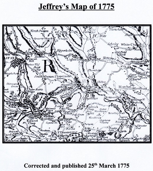
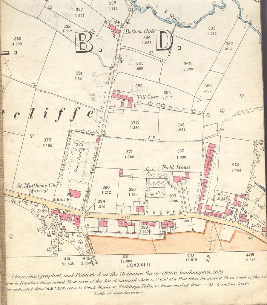
Two more early maps are added with thanks to Chris Helme. The first is the area mapped in 1775 and the second a detailed one centred around the Sun Inn from 1893.
If you want further information or help, please contact us through the website.